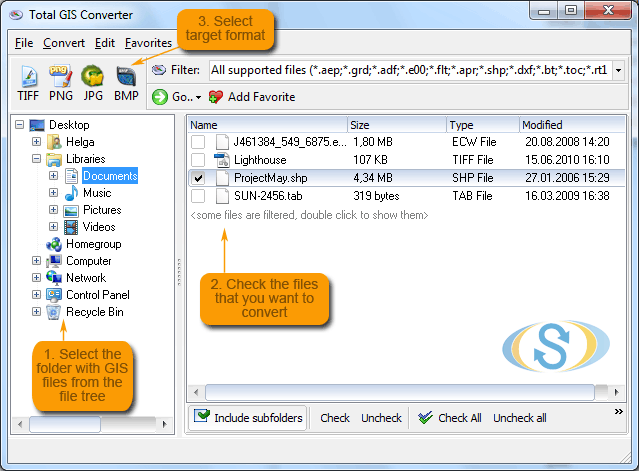
Total GIS Converter is an affordable converter of GIS files. It converts AEP, GRD, ADF, E00, FLT, APR, SHP, DXF, BT, TOC, RT1, DEM, DLG, ECW, IMG, DGF, GML, SID, MIF, TAB, WOR, DNG, DDF, BIL, TIF, JPEG, TTKPS, TTKGP, TTKLS, LFT, PFT, and TFT files. The target formats are TIFF, PNG, JPEG, BMP. The program can scale your GIS files to optimize their size. Besides, it can slice the output files to several parts. Total GIS Converter has easy-to-understand interface plus command line support. Try it for free. Download the trial version now and convert your GIS files.
System Requirements:
WinXP, WinVista, WinVista x64, Win7 x32, Win7 x64, Windows2000, Windows2003, Windows Vista Ultimate, Windows Vista Ultimate x64, Win98, WinME, Win95, Windows Vista Starter, Windows Vista Home Basic, Windows Vista Home Premium, Windows Vista Business, Windows Vista Enterprise, Windows Vista Home Basic x64, Windows Vista Home Premium x64, Windows Vista Business x64, Windows Vista Enterprise x64
Version:
1.5
Last updated:
2015-09-23 13:29:15
Publisher:
Softplicity
Homepage:
http://www.CoolUtils.comFile name:
TotalGISConverter.exe
File size:
7.58MB
License:
Shareware
Price:
99.90