MPSuperShape is a shape manipulation tool for Microsoft MapPoint. MPSuperShape can be used to combine multiple shapes into one large shape, find the intersections (overlaps) between shapes, find boundary shapes around groups of pushpins, simplify shapes, delete multiple shapes, change shape colors, import/export shape files, and to create web pages. Import shape options include ESRI Shape (SHP) files, MapInfo MIF files, Keyhole (KML), and GML. MPSuperShape can also export to ESRI Shape (SHP) files; MapInfo MIF files; GML; KML; pushpins in shapes to Excel; and webpages that use Google Maps or Microsoft Bing Maps (Virtual Earth). Shapefile SHP and MapInfo MIF import/export options support different projections and coordinate systems.
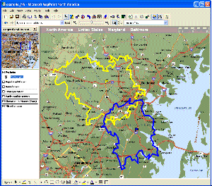
Possible applications include: Combining drive-time areas to find the total area covered by existing depots; Finding territory overlaps; Finding areas which meet multiple characteristics; Finding territory boundaries around groups of customer pushpins; Transferring shapes to/from other GIS systems; Create webpages from MapPoint shapes and pushpins. MPSuperShape provides the following benefits: Combine multiple shapes; Find the intersection (overlap) between shapes; Find boundary shapes around a group of pushpins; Simplify shape definitions for improved MapPoint efficiency; Import shapes from external (non-MapPoint) files; Export shapes to external (non-MapPoint) files; Create webpages that use Bing Maps (Virtual Earth) or Google Maps to display MapPoint pushpins and/or shapes; Copy shapes between different MapPoint maps - reuse the same shapes on multiple maps. The import and export options support GML and KML. GML is an XML-based open GIS format that is managed by the Open Geospatial Consortium. KML ('Keyhole Markup') is the XML language for Google Earth, but it is also supported by Google Maps and Microsoft Bing Maps. Requirements: MapPoint 2006 (or later), .NET Framework 2.0 (or later), and Windows XP, Vista, or Windows 7 required.
System Requirements:
WinXP, Win7 x32, Windows Vista Ultimate, Windows Vista Starter, Windows Vista Home Basic, Windows Vista Home Premium, Windows Vista Business, Windows Vista Enterprise
Version:
2.10
Last updated:
2012-02-28 18:25:24
Publisher:
Winwaed Software Technology LLC
Homepage:
http://www.mapping-tools.comFile name:
MPSuperShapeSetup.msi
File size:
13.57MB
License:
Shareware
Price:
75.00