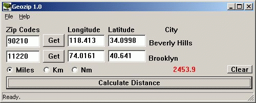
Geozip calculates distance between US (optionally Canadian) zip codes or geographical coordinates, latitude and longitude. It does take into account the curvature of the earth for calculating. You can choose miles, kilometers or nautical miles output. Customixation is available if you need more specific applications using the Geozip geographical distance calculations.
Download
Alternative Download 1
System Requirements:
Win95, Win98, WinME, WinNT 4.x, Windows2000, WinXP
Version:
1
Last updated:
2010-05-06 04:33:35
Publisher:
Island Limited
Homepage:
http://islandlimited.netFile name:
File size:
2.31MB
License:
Shareware
Price:
49